| [1] |
Li Z L, Tang B H, Wu H, et al. Satellite-derived land surface temperature: Current status and perspectives[J]. Remote Sensing of Environment, 2013, 131:14-37.
doi: 10.1016/j.rse.2012.12.008
|
| [2] |
Anderson M, Norman J, Kustas W, et al. A thermal-based remote sensing technique for routine mapping of land-surface carbon, water and energy fluxes from field to regional scales[J]. Remote Sensing of Environment, 2008, 112(12):4227-4241.
doi: 10.1016/j.rse.2008.07.009
|
| [3] |
Kalma J D, McVicar T R, McCabe M F. Estimating land surface evaporation: A review of methods using remotely sensed surface temperature data[J]. Surveys in Geophysics, 2008, 29(4):421-469.
doi: 10.1007/s10712-008-9037-z
|
| [4] |
Wang K, Li Z, Cribb M. Estimation of evaporative fraction from a combination of day and night land surface temperatures and NDVI: A new method to determine the Priestley-Taylor parameter[J]. Remote Sensing of Environment, 2006, 102(3):293-305.
doi: 10.1016/j.rse.2006.02.007
|
| [5] |
Faqe I G. Urban Land Use land cover changes and their effect on land surface temperature: Case study using dohuk city in the Kurdistan Region of Iraq[J]. Climate, 2017, 5(1):13-31.
doi: 10.3390/cli5010013
|
| [6] |
Wan Z, Wang P, Li X. Using MODIS land surface temperature and normalized difference vegetation index products for monitoring drought in the southern Great Plains, USA[J]. International Journal of Remote Sensing, 2010, 25(1):61-72.
doi: 10.1080/0143116031000115328
|
| [7] |
Hain C R, Anderson M C. Estimating morning change in land surface temperature from MODIS day/night observations: applications for surface energy balance modeling[J]. Geophysical Research Letters, 2017, 44(19):9723-9733.
doi: 10.1002/grl.v44.19
|
| [8] |
Neteler M. Estimating daily land surface temperatures in mountainous environments by reconstructed MODIS LST data[J]. Remote Sensing, 2010, 2(1):333-351.
doi: 10.3390/rs1020333
|
| [9] |
Wang F, Qin Z, Song C, et al. An improved mono-window algorithm for land surface temperature retrieval from Landsat 8 thermal infrared sensor data[J]. Remote Sensing, 2015, 7(4):4268-4289.
doi: 10.3390/rs70404268
|
| [10] |
Duan S B, Li Z L, Wang C, et al. Land-surface temperature retrieval from Landsat 8 single-channel thermal infrared data in combination with NCEP reanalysis data and ASTER GED product[J]. International Journal of Remote Sensing, 2018, 40(5-6):1763-1778.
doi: 10.1080/01431161.2018.1460513
|
| [11] |
Mao K, Shi J, Tang H, et al. A neural network technique for separating land surface emissivity and temperature from ASTER Imagery[J]. IEEE Transactions on Geoscience and Remote Sensing, 2008, 46(1):200-208.
doi: 10.1109/TGRS.2007.907333
|
| [12] |
何文英, 陈洪滨, 李军. 陆面微波比辐射率的卫星观测研究进展[J]. 地球物理学报, 2020, 63(10):3573-3584.
|
|
[ He Wenying, Chen Hongbin, Li Jun. Development of land surface microwave emissivity retrieval using satellite observations[J]. Chinese Journal of Geophysics, 2020, 63(10):3573-3584. ]
|
| [13] |
钱博, 陆其峰, 杨素英, 等. 卫星遥感微波地表发射率研究综述[J]. 地球物理学进展, 2016, 31(3):960-964.
|
|
[ Qian Bo, Lu Qifeng, Yang Suying, et al. Review on microwave land surface emissivity by satellite remote sensing[J]. Progress in Geophysics, 2016, 31(3):960-964. ]
|
| [14] |
汪子豪, 秦其明, 孙元亨, 等. 基于BP神经网络的地表温度空间降尺度方法[J]. 遥感技术与应用, 2018, 33(5):793-802.
|
|
[ Wang Zihao, Qin Qiming, Sun Yuanheng, et al. Downscaling of remotely sensed land surface temperature with the bp neural network[J]. Remote Sensing Technology and Application, 2018, 33(5):793-802. ]
|
| [15] |
McFarland M J, Miller R L, Neale C M U. Land surface temperature derived from the SSM/I passive microwave brightness temperatures[J]. IEEE Transactions on Geoscience and Remote Sensing, 1990, 28(5):839-845.
doi: 10.1109/36.58971
|
| [16] |
Fily M. A simple retrieval method for land surface temperature and fraction of water surface determination from satellite microwave brightness temperatures in sub-arctic areas[J]. Remote Sensing of Environment, 2003, 85(3):328-338.
doi: 10.1016/S0034-4257(03)00011-7
|
| [17] |
Gao H, Fu R, Dickinson R E, et al. A practical method for retrieving land surface temperature from AMSR-E over the Amazon Forest[J]. IEEE Transactions on Geoscience and Remote Sensing, 2008, 46(1):193-199.
doi: 10.1109/TGRS.2007.906478
|
| [18] |
Njoku E G, Li L. Retrieval of land surface parameters using passive microwave measurements at 6-18 GHz[J]. IEEE Transactions on Geoscience and Remote Sensing, 1999, 37(1):79-93.
doi: 10.1109/36.739125
|
| [19] |
Mao K, Shi J, Li Z, et al. A physics-based statistical algorithm for retrieving land surface temperature from AMSR-E passive microwave data[J]. Science in China Series D: Earth Sciences, 2007, 50(7):1115-1120.
|
| [20] |
毛克彪, 王道龙, 李滋睿, 等. 利用AMSR-E被动微波数据反演地表温度的神经网络算法[J]. 高技术通讯, 2009, 19(11):1195-1200.
|
|
[ Mao Kebiao, Wang Daolong, Li Zirui, et al. A neural network method for retrieving land-surface temperature from AMSR-E data[J]. Chinese High Technology Letters, 2009, 19(11):1195-1200. ]
|
| [21] |
Sun D, Li Y, Zhan X, et al. Land surface temperature derivation under all sky conditions through integrating AMSR-E/AMSR-2 and MODIS/GOES observations[J]. Remote Sensing, 2019, 11(14):1704.
doi: 10.3390/rs11141704
|
| [22] |
Tan J, Esmaeel N, Mao K, et al. Deep learning convolutional neural network for the retrieval of land surface temperature from AMSR2 data in China[J]. Sensors, 2019, 19(1):2987-3007.
doi: 10.3390/s19132987
|
| [23] |
Huang G, Wu L, Ma X, et al. Evaluation of CatBoost method for prediction of reference evapotranspiration in humid regions[J]. Journal of Hydrology, 2019, 574:1029-1041.
doi: 10.1016/j.jhydrol.2019.04.085
|
| [24] |
Zhang Y, Zhao Z, Zheng J. CatBoost: A new approach for estimating daily reference crop evapotranspiration in arid and semi-arid regions of Northern China[J]. Journal of Hydrology, 2020, 588(125):87-99.
|
| [25] |
姜琦刚, 杨秀艳, 杨长保, 等. 基于CatBoost算法的面向对象土地利用分类[J]. 吉林大学学报(信息科学版), 2020, 38(2):185-191.
|
|
[ Jiang Qigang, Yang Xiuyan, Yang Changbao, et al. Object-oriented land use classification based on CatBoost algorithm[J]. Journal of Jilin University(Information Science Edition), 2020, 38(2):185-191. ]
|
| [26] |
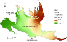
王新军, 赵成义, 杨瑞红, 等. 古尔班通古特沙漠南缘荒漠化过程演变的景观格局特征分析[J]. 干旱区地理, 2015, 38(6):1213-1225.
|
|
[ Wang Xinjun, Zhao Chengyi, Yang Ruihong, et al. Landscape pattern characteristics of desertification evolution in southern Gurbantunggut Desert[J]. Arid Land Geography, 2015, 38(6):1213-1225. ]
|
| [27] |
Mamtimin A, Wang Y, Sayit H, et al. Seasonal variations of the near-surface atmospheric boundary layer structure in China’s Gurbantünggüt Desert[J]. Advances in Meteorology, 2020: 6137237.
|
| [28] |
段呈, 吴玲, 王绍明, 等. 近30年古尔班通古特沙漠短命植物的时空格局[J]. 生态学报, 2017, 37(8):2642-2652.
|
|
[ Duan Cheng, Wu Ling, Wang Shaoming, et al. Analysis of spatio-temporal patterns of ephemeral plants in the Gurbantünggüt Desert over the last 30 years[J]. Acta Ecologica Sinica, 2017, 37(8):2642-2652. ]
|
| [29] |
陈林, 王式功, 王莉莉. 新疆阜康地区秋季大气NOx和O3变化特征及影响要素[J]. 干旱气象, 2012, 30(3):345-352.
|
|
[ Chen Lin, Wang Shigong, Wang Lili. Variation characteristics and influencing factors of NOx and Ozone in autumn in Fukang Region of Xinjiang[J]. Journal of Arid Meteorology, 2012, 30(3):345-352. ]
|
| [30] |
范永东. 模型选择中的交叉验证方法综述[D]. 太原: 山西大学, 2013.
|
|
[ Fan Yongdong. A Summary of Cross-Validation in Model Selection[D]. Taiyuan: Shanxi University, 2013. ]
|
| [31] |
郝静, 孙成, 郭兴宇, 等. 京津冀内陆平原区PM2.5浓度时空变化定量模拟[J]. 环境科学, 2018, 39(4):1455-1465.
|
|
[ Hao Jing, Sun Cheng, Guo Xingyu, et al. Simulation of the spatio-temporally resolved PM2.5 aerosol mass concentration over the inland plain of the Beijing-Tianjin-Hebei region[J]. Environmental Science, 2018, 39(4):1455-1465. ]
|
| [32] |
金旭峰, 吴莹, 钱博. 基于AMSR2数据的青藏高原地表温度反演[J]. 地球物理学进展, 2020, 35(4):1269-1275.
|
|
[ Jin Xufeng, Wu Ying, Qian Bo. Retrieval of land surface temperature from AMSR2 data over the Qinghai-Tibetan Plateau[J]. Progress in Geophysics, 2020, 35(4):1269-1275. ]
|
| [33] |
Bhagat V S. Space-borne passive microwave remote sensing of soil moisture: A review[J]. Recent Progress in Space Technology, 2015, 4(2):119-150.
|
| [34] |
Prokhorenkova L, Gusev G, Vorobev A, et al. CatBoost: Unbiased boosting with categorical features[J]. Advances in Neural Signal Processing, 2018: 6638-6648.
|
| [35] |
Zhang K, Schölkopf B, Muandet K, et al. Domain adaptation under target and conditional shift[C]// 30th International Conference on Machine Learning, ICML, 2013: 1856-1864.
|
| [36] |
Colliander A, Jackson T J, Bindlish R, et al. Validation of SMAP surface soil moisture products with core validation sites[J]. Remote Sensing of Environment, 2017, 191:215-231.
doi: 10.1016/j.rse.2017.01.021
|
| [37] |
陶本藻, 邱卫宁, 张书毕, 等. 误差理论与测量平差[M]. 武汉: 武汉大学出版社, 2012.
|
|
[ Tao Benzao, Qiu Weining, Zhang Shubi, et al. Error Theory and Measurement Adjustment[M]. Wuhan: Wuhan University Press, 2012. ]
|
| [38] |
毛克彪, 胡德勇, 黄健熙, 等. 针对被动微波AMSR-E数据的土壤水分反演算法[J]. 高技术通讯, 2010, 20(6):651-659.
|
|
[ Mao Kebiao, Hu Deyong, Huang Jianxi, et al. A algorithm for retrieving soil moisture from AMSR-E passive microwave data[J]. Chinese High Technology Letters, 2010, 20(6):651-659. ]
|
| [39] |
Wang W, Liang S, Meyers T. Validating MODIS land surface temperature products using long-term nighttime ground measurements[J]. Remote Sensing of Environment, 2008, 112(3):623-635.
doi: 10.1016/j.rse.2007.05.024
|
| [40] |
于文凭, 马明国. MODIS地表温度产品的验证研究——以黑河流域为例[J]. 遥感技术与应用, 2011, 26(6):705-712.
|
|
[ Yu Wenping, Ma Mingguo. Validation of the MODIS land surface temperature products: A case study of the Heihe River basin[J]. Remote Sensing Technology and Application, 2011, 26(6):705-712. ]
|
| [41] |
Huang R, Huang J-x, Zhang C, et al. Soil temperature estimation at different depths, using remotely-sensed data[J]. Journal of Integrative Agriculture, 2020, 19(1):277-290.
doi: 10.1016/S2095-3119(19)62657-2
|
 ),王新军1(